
OnlineBrowser modeAlerts optional
PHONE + WEB TOOLSQuick controls
View all ↗Pocket KitOffline + field toolsNotification PreferencesChoose topics + townsLaunch Price LabBuild an estimateMarketplaceHire + createResourcesGuides + checklistsFind CreatorsReviewed profilesCreator GigsPaid opportunitiesPost a GigScope + budget + datesIndustry JobsVerified CT openingsMy MarketplaceProjects + payouts
All site links
SCALE • LOCATION • MOVEMENT
Drone & Aerial Video Across Connecticut.
Aerial and motion footage that establishes place, reveals scale, tracks activity, and adds cinematic perspective to a larger production.
BUILT AROUND THE OUTCOME
One team from planning through final delivery.
Aerial coverage is planned around the story, location, weather, airspace, safety, and final edit. When flight is not appropriate, gimbals, sliders, and elevated camera positions keep the production moving.
CT Video Services is fully mobile, so the camera, lighting, live audio, broadcast, and editing workflow can be designed around your location instead of forcing the project into a fixed studio.
Property, campus, and venue coverage
Event and project-progress perspectives
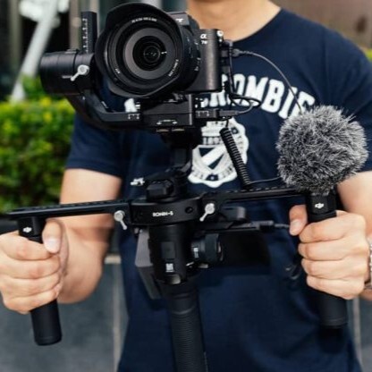
Gimbal, slider, and motion alternatives
6 DISTINCT SPECIALTIES
Go deeper than the service family.
These focused production options answer specific buyer needs while this page remains the stable statewide service center for all 169 Connecticut towns.
DRONE & AERIAL
Cinematic Drone Video
Aerial establishing, tracking, reveal, and scale shots planned around story, airspace, safety, weather, and privacy.
Explore specialty ↗DRONE & AERIALConstruction Progress Aerials
Repeatable aerial perspectives that document site change over time without claiming survey-grade measurement.
Explore specialty ↗DRONE & AERIALProperty Aerial Video
Context-rich aerial coverage showing access, surroundings, property scale, and outdoor features subject to flight approval.
Explore specialty ↗DRONE & AERIALEvent Aerial Coverage
High-level event context captured only when crowd, venue, airspace, weather, and operational rules permit safe flight.
Explore specialty ↗DRONE & AERIALFPV Drone Production Coordination
Specialized FPV movement coordinated with an appropriately qualified pilot, location, safety plan, and production crew.
Explore specialty ↗DRONE & AERIALElevated Camera & No-Fly Alternatives
Jibs, poles, elevated positions, gimbals, and ground movement used when drone flight is unsafe, restricted, or unnecessary.
Explore specialty ↗40 ANSWERS • AIRSPACE • SCALE • SAFETY
Buyers ask. We answer.
Drone, Aerial & Elevated Camera Video—pricing, planning, permissions, production, delivery, and the details that prevent surprises.
Open all 40 answers ↗169 LOCAL SERVICE PAGES
Find Drone & Aerial in your Connecticut town.
Every link opens a local page built around this service, the town, its region, related production options, and a direct quote path.
38 TOWNS
Capitol Region
06 TOWNS
Greater Bridgeport
17 TOWNS
Lower Connecticut River Valley
19 TOWNS
Naugatuck Valley
16 TOWNS
Northeastern Connecticut
21 TOWNS
Northwest Hills
15 TOWNS
South Central Connecticut
19 TOWNS
Southeastern Connecticut
18 TOWNS
Western Connecticut
ESTIMATE • QUOTE • SECURE YOUR DATE
Build the production. Know the range.
Use the free estimator without giving us your information, then unlock CT Video Services' exact planning quote—or skip the calculator and tell a producer what you need.
FREE • NO EMAIL REQUIRED FOR YOUR RANGE
Build the production. Watch the price respond.
Get a realistic Connecticut market range in about 90 seconds, then choose whether to unlock CT Video Services' exact planning quote.
ORTell us the project and let a producer build it.
TALK TO A REAL PRODUCERSkip the calculator.